
City and ZIP code rank tracking
Track Google Maps Rankings by City and ZIP Code
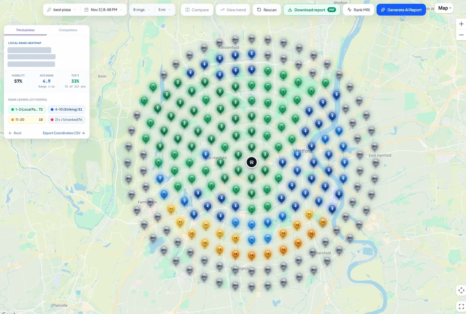
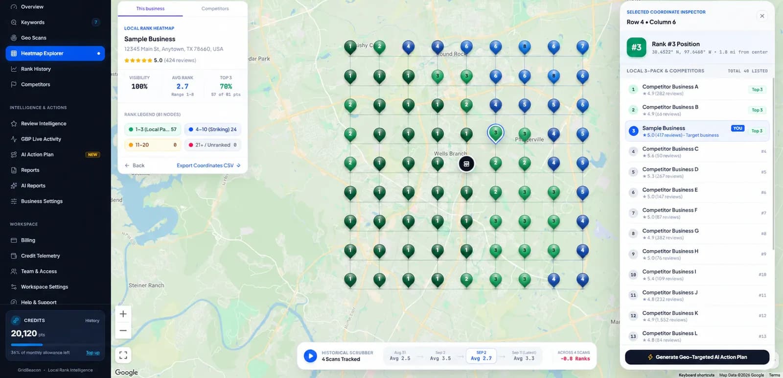
Your Google Maps rank is different in every part of town. A geo-grid runs the same search from points across a city or a ZIP code and maps your position at each one, so you can see which neighbourhoods you win and which go to competitors.
No credit card required. New accounts get 500 free scan credits.
- Grids 3 × 3 to 21 × 21 (9 to 441 points)
- Radius 0.1 to 100 miles
- 1 credit per point
The problem
Why One Rank Check Is Not Your City-Wide Rank
Google weighs relevance, prominence and distance when it ranks local results. Distance changes with every searcher, so a plumber can hold #1 in their own ZIP code and not appear at all five miles away.
Tracking by city or ZIP code means measuring rank where your customers actually are. A geo-grid does that by searching from many fixed points at once and putting the answers on a map.
Searching your keyword from your own office shows the result for that spot. Customers searching from the other side of the city, or from the next ZIP code, see a different map pack.
How it works
Cover a City or ZIP Code With a Geo-Grid
Pick the centre
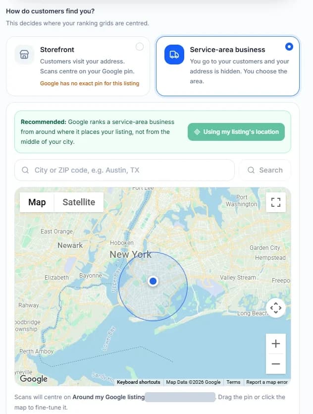
Scans centre on where Google places your listing. Service-area businesses can instead search a city or ZIP code, or drag a pin, to centre the grid there.
Set the reach
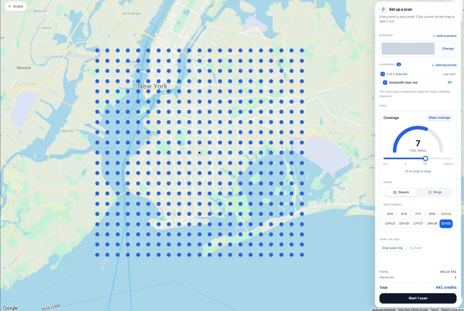
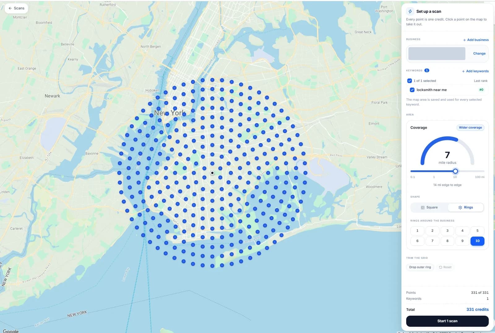
Choose a radius from 0.1 to 100 miles and a square grid or rings so the scan covers the ZIP codes or the part of the city you serve, and switch off points over water or empty land.
Read it block by block
Each point shows your rank and every business ranked there, so you can see which neighbourhoods you hold and who takes the others.
Service-area businesses choose their own centre. When the address is hidden on Google, GridBeacon asks where scans should centre: the area around where Google places the listing (recommended), a city or ZIP code you search, or a point you drag the pin to.
Storefronts centre on their Google pin. Customers come to the address, so the grid starts there and the radius decides how far across the city it reaches.
Sizing
Grid Sizes for Cities and ZIP Codes
Starting points, not rules. Keep the same settings from scan to scan so results stay comparable.
| Area to cover | Grid and radius | Credits per keyword scan |
|---|---|---|
| One ZIP code or neighbourhood | 5 × 5 to 7 × 7, 1–3 miles | 25–49 |
| A small city | 7 × 7 to 9 × 9, 3–6 miles | 49–81 |
| A large city | 11 × 11 to 13 × 13, 8–15 miles | 121–169 |
| A metro area across several cities | 15 × 15 to 21 × 21, 15–30 miles | 225–441 |
Setup
Track Your First City in Four Steps
Add your business
Find it on Google Maps by name or paste its Maps link.
Choose the centre
Use the listing's location, or for a service-area business a city, ZIP code or pin.
Size the grid
Pick a grid and radius that cover the area, then add your keywords.
Scan and schedule
Run the first scan, then repeat it weekly or monthly to see each area move.
Straight answer
What City and ZIP Tracking Does Not Do
- There is no separate report per ZIP code: one scan gives one heatmap of the whole area.
- Points are not labelled with ZIP codes; read the map against the streets you know.
- A storefront business's scans centre on its listing, not on another city.
- It measures Google Maps only, not organic results.
FAQ
City and ZIP Code Rank Tracking Questions
Can I track Google Maps rankings by ZIP code?
Yes, by covering the ZIP code with a geo-grid. GridBeacon runs the same Google Maps search from every point of a grid and shows your rank at each one, so you can see where in a ZIP code you appear in the map pack. Service-area businesses can centre the grid on a ZIP code directly; other businesses centre on their listing and set the radius to reach the ZIP codes they care about.
Why does my Google Maps ranking change from one ZIP code to the next?
Google ranks local results partly by distance between the searcher and each business. A customer three ZIP codes away sees a different map pack from one next door, so one rank check shows only the spot it was run from.
Can I track rankings in a city I'm not based in?
A geo-grid can reach well beyond your address: grids run up to 21 × 21 points and a 100-mile radius. Service-area businesses can also centre the scan on another city or ZIP code they serve. Expect lower ranks far from your listing; that is how Google weighs distance, and the map shows exactly where it happens.
Do I get a separate report for each ZIP code?
No. Each scan produces one heatmap of the whole area, with your rank at every point and who ranked at each point. Use a grid and radius that cover the ZIP codes you serve, and read the map neighbourhood by neighbourhood.
How much does it cost to track a city?
One credit per grid point. A 9 × 9 grid across a city uses 81 credits per keyword per scan. New accounts get 500 free credits, and paid plans start at $19.99 a month for 8,000 credits.
See Your Rank Across the Whole City
Scan your main keyword across your city or ZIP codes with 500 free credits.
No credit card required.